
Vendor:C-Map
C-MAP M-NA-D039 4D microSD US Rivers OH, TN-Tom, Cumberland
Overview
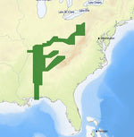
C-MAP M-NA-D039 4D microSD US Rivers OH, TN-Tom, Cumberland by C-Map. MPN/Model: M-NA-D039-MS. Condition: New unit. Category: C-MAP - 4D CHARTS.
Key features
- Full-Feature Vector Charts: Toggle different views on and off to see animated tidal streams, currents and flows on your map. When planning your trip, check out the tidal heights so you won't be caught
- Dynamic Raster - Traditional "paper chart" look with unique ability to access information on buoys, lights and other details. (Exclusive to 4D Max+)
- 3D View - Stunning three-dimensional views of land elevation and bottom contours bring the world around (and under) your boat to life. (Exclusive to 4D Max+)
- Satellite - High-resolution satellite imagery provides real-world reference, enhances situational awareness for coastal navigation. (Exclusive to 4D Max+)
- High Resolution Bathy Data - The highest available detail of underwater pinnacles, ledges and canyons that are magnets for offshore and coastal gamefish.
- Sport Fishing Data - Provides angling intelligence for wrecks and reefs, Fish ID photos, fishing tips, updated regulations, state records and more.
Notes
Please verify compatibility with your existing network, transducer, and mounting requirements before purchase.